


|
Getting your Trinity Audio player ready...
|
The North Atlantic Igneous Province (NAIP) is a vast volcanic region formed 60-55 million years ago, significantly impacting Earth’s climate and geology, and potentially contributing to the Paleocene–Eocene Thermal Maximum (PETM).

The North Atlantic Igneous Province (NAIP) is one of the most significant volcanic regions on Earth, spanning parts of the North Atlantic, including Greenland, Iceland, the Faroe Islands, Norway, Ireland, and Scotland. This extensive volcanic province formed primarily during the Paleogene period, around 60 to 55 million years ago, and played a crucial role in shaping the geology of the North Atlantic region. The NAIP is characterized by vast lava flows, intrusive igneous rocks, and volcanic activity that had profound implications for Earth’s climate and environment, including a potential role in triggering the Paleocene–Eocene Thermal Maximum (PETM).
Formation of the NAIP
The formation of the NAIP is closely linked to the opening of the North Atlantic Ocean. During the late Paleocene and early Eocene epochs, the breakup of the supercontinent Pangaea led to the separation of Greenland from Europe. This tectonic activity resulted in the creation of new oceanic crust and the formation of extensive volcanic features.
Rifting and Volcanism
The rifting process that led to the formation of the North Atlantic Ocean was accompanied by intense volcanic activity. As the continental plates pulled apart, magma from the mantle rose to the surface, leading to widespread volcanic eruptions. These eruptions produced large volumes of basaltic lava, which spread across the landscape, creating extensive lava plateaus and volcanic islands.
Mantle Plumes
One of the driving forces behind the NAIP’s volcanic activity is believed to be mantle plumes. Mantle plumes are columns of hot, upwelling mantle material that can cause significant volcanic activity when they reach the Earth’s surface. The Iceland plume, in particular, is thought to have played a key role in the formation of the NAIP. This plume is responsible for the continuous volcanic activity in Iceland today and was likely a major contributor to the NAIP’s formation millions of years ago.
Geological Features
The NAIP is characterized by a variety of geological features that highlight its volcanic origins. These features include extensive lava flows, volcanic islands, and large igneous intrusions.
Lava Flows
One of the most prominent features of the NAIP is its extensive lava flows. These flows are primarily composed of basalt, a type of volcanic rock that forms from the rapid cooling of lava at the surface. In some areas, the lava flows are several kilometers thick, indicating the immense scale of volcanic activity that occurred during the NAIP’s formation.
Volcanic Islands
The NAIP includes several volcanic islands, such as Iceland and the Faroe Islands. These islands are the result of volcanic eruptions that occurred as the North Atlantic Ocean was opening. Iceland, in particular, is a geologically active region, with ongoing volcanic activity that continues to shape its landscape.
Intrusive Igneous Rocks
In addition to surface lava flows, the NAIP is characterized by large igneous intrusions. These are bodies of magma that solidified beneath the Earth’s surface, forming extensive networks of igneous rock. The most famous of these intrusions is the Skaergaard intrusion in East Greenland, which is one of the best-studied layered mafic intrusions in the world. It provides valuable insights into the processes of magma differentiation and crystallization.
Environmental Impact
The volcanic activity associated with the NAIP had significant environmental impacts, both locally and globally. The large-scale eruptions released massive amounts of volcanic gases, including carbon dioxide (CO₂) and sulfur dioxide (SO₂), into the atmosphere. These gases had profound effects on the climate and environment.
Climate Change
The release of CO₂ during the NAIP’s volcanic eruptions contributed to global warming. This greenhouse gas traps heat in the atmosphere, leading to higher temperatures. The PETM, a period of rapid global warming that occurred around 55.8 million years ago, is closely linked to the volcanic activity of the NAIP. The massive release of carbon from the NAIP is thought to have triggered this climatic event, causing temperatures to rise by 5–8°C (9–14°F).
Ocean Acidification
The volcanic activity also led to ocean acidification. The release of CO₂ into the atmosphere resulted in higher concentrations of carbonic acid in the oceans, lowering the pH and making the waters more acidic. This acidification had adverse effects on marine life, particularly organisms with calcium carbonate shells, such as corals and certain types of plankton. The increased acidity dissolved these shells, leading to a decline in these populations and disrupting marine ecosystems.
Key Locations of the NAIP
The NAIP spans several key locations, each with unique geological features and significance:
Iceland
- Location: Iceland is a volcanic island situated in the North Atlantic Ocean, directly above the Mid-Atlantic Ridge.
- Geological Significance: Iceland’s volcanic activity is driven by both the Mid-Atlantic Ridge and a mantle plume beneath the island, making it one of the most volcanically active regions on Earth. The extensive basalt lava flows and numerous volcanic systems provide insights into mantle plume dynamics and mid-ocean ridge processes.

View of Thórsmörk valley from the summit of Mt. Valahnúkur, Thórsmörk National Park, Iceland.
Faroe Islands
- Location: The Faroe Islands are located between Iceland and Norway in the North Atlantic.
- Geological Significance: The islands are composed predominantly of basaltic lava flows that erupted during the Paleogene period. The Faroe Islands offer important evidence of the volcanic activity associated with the opening of the North Atlantic Ocean.
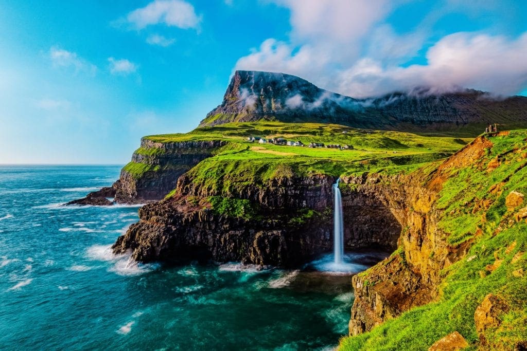
The Mulafossure waterfall on a sunny day in the Faroe Islands
East Greenland
- Location: Eastern Greenland, along the coast of the Greenland Sea.
- Geological Significance: East Greenland features extensive volcanic rock formations, including large basalt plateaus formed during the NAIP. The region also includes significant igneous intrusions like the Skaergaard intrusion, providing valuable insights into magmatic processes and crustal formation.

East Greenland.
Scotland
- Location: Scotland, particularly the west coast and the Inner Hebrides.
- Geological Significance: Scotland’s volcanic rocks, such as those found on the Isle of Skye and the Antrim Plateau, are part of the NAIP. These formations include thick sequences of basalt lava flows and intrusive igneous rocks, which help understand the volcanic history and tectonic evolution of the region.

Basalt columns at Fingal’s cave at Staffa Island in Scotland.
Northern Ireland
- Location: Northern Ireland, particularly the Antrim Plateau.
- Geological Significance: The Antrim Plateau features extensive basalt lava flows that are part of the NAIP. The Giant’s Causeway, a famous natural wonder, consists of hexagonally jointed basalt columns formed during this volcanic activity.

ntrim Coast in Summer: The cliffs of Fair Head from Rathlin Island in County Antrim, Northern Ireland.
Norway
- Location: Coastal regions of Norway along the Norwegian Sea.
- Geological Significance: Norway’s volcanic rocks are part of the NAIP, with evidence of extensive lava flows and intrusive igneous formations. The volcanic activity in this region is linked to the rifting and opening of the North Atlantic Ocean.

Beerenberg volcano on a foggy morning on Jan Mayen volcanic island in the Norwegian Sea.
Economic and Scientific Importance
The NAIP is not only a geological wonder but also holds significant economic and scientific importance. The region’s rich geological history provides valuable insights into volcanic processes, plate tectonics, and the Earth’s climate system.
Natural Resources
The volcanic rocks of the NAIP are a source of various natural resources, including minerals and geothermal energy. For example, Iceland’s abundant geothermal energy is a direct result of its volcanic activity. The heat from underground magma is harnessed to generate electricity and provide heating, making Iceland a leader in renewable energy.
Scientific Research
The NAIP is a key area of study for geologists and volcanologists. Research in this region helps scientists understand the processes of volcanic activity, magma formation, and the impacts of volcanic eruptions on the climate and environment. The NAIP’s unique geological features, such as the Skaergaard intrusion and the lava flows of East Greenland, offer valuable opportunities for scientific exploration and discovery.
Conclusion
The North Atlantic Igneous Province is a remarkable geological region that played a crucial role in shaping the North Atlantic’s geological landscape. Its formation was driven by tectonic processes and mantle plumes, resulting in extensive volcanic activity and the creation of unique geological features. The environmental impacts of the NAIP’s volcanic eruptions were profound, contributing to global climate change and ocean acidification.
Today, the NAIP continues to be a vital area of scientific research and economic importance, offering insights into the Earth’s volcanic processes and providing valuable natural resources. Understanding the NAIP helps us appreciate the dynamic nature of our planet and the powerful forces that shape its surface.
Popular Articles:
When Exploring Hawaii’s Natural Beauty Is Your Day Job
Exploring the Cascade Lakes Highway: A Scenic Adventure Through Central Oregon
Roark’s Journey Shirt: Your New Go-To for Effortless Style


